Route and Location Monitoring

Route and Location Monitoring

Omnicomm route monitoring system shows where every vehicle is right now, which route it took, where it stopped and for how long — with the fuel level on the same timeline.

  • 1998on the market since
  • 1.5Mvehicles equipped
  • 100+countries
  • 30+industries

What the route monitoring system shows

Live location

Current or last known position on the map.

Track history

The actual route of every trip.

Checkpoints

Were planned points visited, and for how long.

Movement and stops

Driving periods, standstills and their duration.

Refuelling on the map

Every refuelling tied to the station where it happened.

Fuel per route

Litres burned on each trip and route segment.

Route monitoring with and without fuel data

GPS tracker onlyGPS tracker + fuel sensor
Where the vehicle is now✓✓
Which route it took✓✓
Where and how long it stopped✓✓
Did it refuel at that stop✕✓
Was fuel drained during the stop✕✓

How vehicle route and location tracking works

Optim

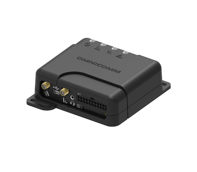
1. GPS tracker

Records position, speed and stops.

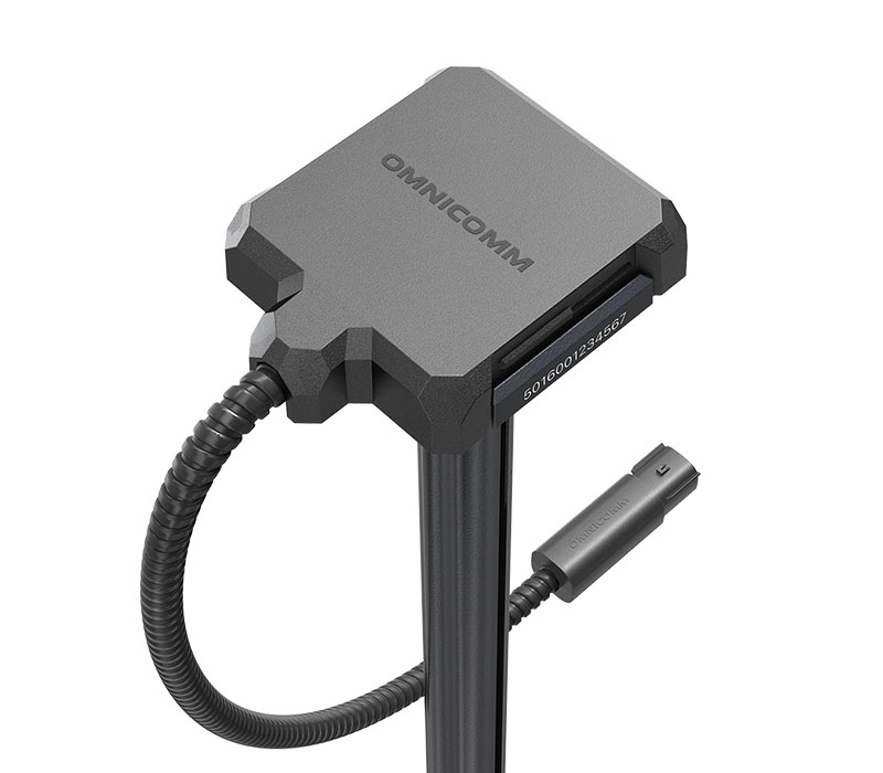
Omnicomm LLS 5 capacitive fuel level sensor

2. Fuel level sensor

Adds the litres in the tank to every point of the track.

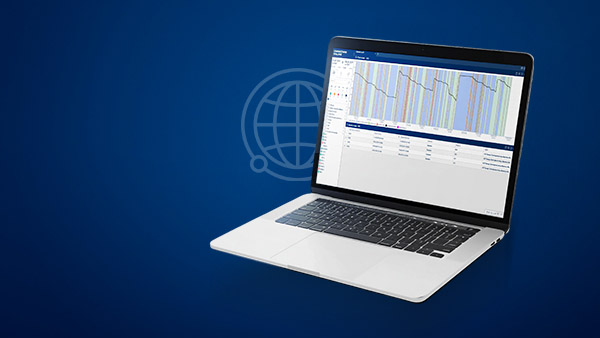
Omnicomm Online fuel consumption monitoring software

3. Omnicomm Online

Location, Track and Standstills reports.

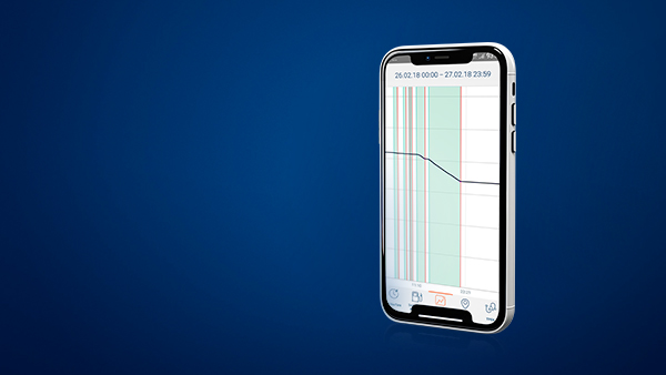
Omnicomm Online mobile app

4. Any device

The same live map on a desktop, tablet or phone.

Route monitoring results

$20,300

saved per month · Dhara Logistics, India

Read the case →

12%

fuel saved per trip · Dhara Logistics, India

Read the case →

15–40%

lower fuel consumption in 2 months · Belgrade

Read the case →

4 months

to ROI on 850 trucks · ABInBev Africa

Read the case →

See every route — and every litre on it

Tell us about your fleet and routes — we will show what route and fuel data reveal in a demo.

Transportation monitoring for every type of fleet

Freight and logistics

Delays and unplanned stops on long routes.

Municipal services

Waste collection and utility vehicles with many stops.

Construction and mining

Machinery moving between sites and pits.

Agriculture

Machinery movement across fields and farms.

Route monitoring and real-time vehicle location for fleets

A route monitoring system records the position of every vehicle with a GPS tracker and turns it into a picture managers can act on: the live location, the actual route of each trip, stops and their duration, and deviations from the planned route. Omnicomm adds fuel data to that picture, so every kilometre and every stop can be checked against the litres in the tank.

Read more about route monitoring

Real-time vehicle location and track history

The Location report in Omnicomm Online shows the current or last known position of each vehicle, and the Track report shows its movement history on the map. The Movement and Standstills reports split each day into driving and stopped periods, and checkpoint control verifies that planned route points were visited and how long the vehicle spent at each of them.

Why route monitoring needs fuel data

A GPS tracker can show that a truck stopped at an unscheduled place for 20 minutes. Without a fuel sensor you cannot tell whether the driver had lunch or drained 50 litres of diesel. With Omnicomm fuel level sensors, refuelling is tied to the station where it happened, drains are tied to the location, and fuel consumption can be compared across route segments. Unauthorized trips, long idling and drains appear in the same report as the route — see fuel consumption control.

Transportation monitoring in practice

Route monitoring matters most for freight transport, municipal services, heavy machinery, agricultural machinery and passenger transport. Dhara Logistics in India could not see delays on its freight routes before installing GPS trackers and Omnicomm fuel sensors on 60 vehicles; it now saves 12% of fuel per trip. For control of sites and zones, see geofencing control; for speeding and driving style along the route, see speed and driving behavior control; to tie each trip to a person, see driver control.

Coverage gaps and existing trackers

Omnicomm GPS trackers keep data when there is no network and upload it later, so the route is not lost on remote roads. Omnicomm fuel sensors also work with third-party trackers that support the LLS protocol, so fuel data can be added to an existing route monitoring setup.

Route monitoring system FAQ

What is a GPS fuel monitoring system and how is it different from a GPS tracker?

A GPS fuel monitoring system combines a GPS tracker (which captures location, speed, and ignition state) with a precision fuel level sensor inside the tank, plus software that ties the two together. A standard GPS tracker shows where a vehicle is. A GPS fuel monitoring system shows where the vehicle is and how much fuel it has, received, or lost, at every point in the journey.

The distinction matters because most fleet operators start with GPS tracking alone and then realize the data gap. A GPS tracker can tell you that a vehicle stopped at an unscheduled location for 20 minutes. Without a fuel sensor, you cannot know whether the driver was eating lunch or siphoning 50 liters of diesel. A complete GPS fuel monitoring system removes the ambiguity by reporting actual fuel volume on the same timeline as the GPS trail. The hardware combination is straightforward: an OMNICOMM LLS fuel level sensor wired via the digital LLS protocol into whichever GPS tracker the buyer already runs or chooses to install. Because the LLS protocol is an open industry standard supported by virtually every modern fleet telematics tracker, most operators can add precision fuel monitoring without changing telematics providers. The same hardware works on light commercial vehicles, heavy trucks, off-road equipment, and stationary tanks.

Can vehicle tracking and fuel monitoring be combined in one system?

Yes. A unified vehicle tracking and fuel monitoring system pairs a GPS tracker (capturing location, speed, ignition, and driver behavior) with a connected LLS fuel sensor (capturing the in-tank fuel level), with both data streams flowing into one software platform. OMNICOMM LLS sensors plug into any tracker that supports the LLS protocol, which is virtually every modern fleet telematics terminal, so the combined platform can be built on the OMNICOMM stack or on the buyer's existing telematics provider.

Running tracking and fuel monitoring as separate platforms is the most common operational pain point fleets bring to OMNICOMM. Two platforms means two licenses, two dashboards, two sets of alerts, and constant data reconciliation between systems whose timestamps and vehicle IDs often disagree. A unified architecture eliminates that overhead. A single login shows real-time vehicle position on the map with fuel level overlaid, every refuel event is geo-tagged to the station where it happened, and every drain event is tagged to the location and driver responsible. Reports combine route, speed, idle time, fuel consumption, and theft alerts in one view. For fleets already running a third-party tracking platform they want to keep, OMNICOMM LLS sensors integrate directly via the LLS protocol so fuel data feeds into the existing telematics platform without forcing a switch. White-label partners often deliver the combined platform under their own brand.

What is the best fuel monitoring system for trucks?

The best fuel monitoring system for trucks combines a precision in-tank fuel sensor, a reliable GPS tracker, and software that handles long-haul, multi-stop trip patterns. The recommended OMNICOMM sensor for most diesel trucks (delivery vans through heavy long-haul) is the LLS 5 or LLS 6 AI, paired with whichever tracker the buyer already runs or a Profi-class tracker for new builds. For trucks on routes with poor cellular coverage, choose a tracker with onboard buffering and a Wi-Fi uplink so events upload when the vehicle returns to depot.

Truck monitoring has three challenges that compound each other and that a fuel sensor system needs to solve simultaneously. Trucks refuel at different stations along a route, so fuel composition shifts trip to trip and OMNICOMM sensors with FuelScan auto-adapt without manual recalibration. A typical 650-liter diesel tank holds several hundred dollars of fuel, so theft attempts are larger and more sophisticated than on light fleets, which is why precision sensors detect drains as small as 5 liters and reconcile against fuel-card transactions. And long-haul routes cross out-of-coverage zones, where the Profi 3.0 Wi-Fi tracker buffers events locally and uploads them on return to depot. Truck-fleet results bear this out: ARSS Infrastructure in India runs the OMNICOMM stack across one of the largest commercial truck fleets in the country and reports a 24 percent reduction in fuel spend, and Dhara Logistics improves fuel spend 12 percent across a 60-truck fleet for around $20,300 in monthly savings.

What are OMNICOMM Optim and Profi GPS trackers used for?

Optim 3.0 is the reliable freight-transport tracker. It supports GPRS and SMS, integrates easily with LLS sensors, and is rated IP52. Profi 3.0 is built for extreme conditions, with wide voltage tolerance, heavy vibration resistance, IP54, used in mining, construction, and fuel tankers. Profi 3.0 Wi-Fi adds local-network data transfer for sites with no cellular coverage. All trackers carry a 3-year warranty.

Optim 3.0 is the right choice for delivery vans, light commercial diesel trucks, and freight fleets operating in areas with stable cellular coverage. It is the lower-cost tracker in the lineup and integrates with standard fleet management workflows. Profi 3.0 steps up to handle the abuse heavy diesel machinery delivers daily: temperature extremes from minus 40 to plus 85 Celsius, voltage spikes from auxiliary equipment, vibration from off-road operation, and dust ingress from quarries and construction sites. It is the recommended tracker for diesel excavators, haul trucks, drilling rigs, cranes, and tankers. Profi 3.0 Wi-Fi adds a critical capability for remote operations: when the vehicle returns to a Wi-Fi hotspot at the depot or worksite, it offloads buffered data automatically. This is the standard for mining fleets in remote areas, agricultural operations across large fields, and any site where cellular service is unreliable or expensive. All three trackers speak the OMNICOMM LLS protocol over RS-485, which lets partners pair them with OMNICOMM sensors or mix and match with third-party hardware.

Can I access Omnicomm Online from a phone or tablet?

Yes. Omnicomm Online is a responsive web application that runs in any modern browser on a desktop, tablet, or smartphone. Fleet managers, dispatchers, and operators log in from any device with internet access and see the same real-time fuel and location data. No native app installation is required, the platform is GDPR compliant, and access is role-based.

The web-first approach is intentional and has three practical benefits. New features and bug fixes roll out instantly to every user without app-store review cycles or version fragmentation across the fleet. IT teams do not have to push installations to drivers' personal devices, which is the biggest source of friction in mobile-app rollouts. And partners running white-label deployments maintain a single platform rather than separate iOS, Android, and web codebases. Critical events such as fuel drains, geofence breaches, and threshold consumption are delivered through email and SMS alerts, so important notifications reach the right person whether they are at a desktop or on the road. OMNICOMM does not ship a native iOS or Android app and has no plans to, since the web platform delivers the same functionality at a lower lifecycle cost. White-label partners with a specific reason to ship a branded native app can build their own native shell over the responsive web platform.

All questions →

BECOME OUR PARTNER OR CLIENT